UAV laser scanners
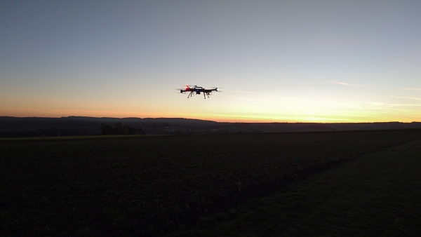
The drone scanner category includes various types of laser scanners, all of which can be used to measure from an unmanned aerial vehicle. Riegl's scanners also include the remotely controlled RiAcquire software for data collection.
The biggest difference from scanners from other manufacturers is the multi-point measurement feature, which allows you to measure the ground surface even in areas covered by vegetation.
The biggest differences between the devices are in measurement accuracy, the speed of the platform enabled by the device, and the flight altitude. It is worth remembering that the category of drone scanners partially overlaps with airborne laser scanners.
RIEGLThe goal is to have the most even point cloud distribution possible, which is why the point distribution of the drone measurement can also be planned in advance with a free RiPARAMETERtool. In addition to the scanning system used, boundary conditions such as the desired flight altitude and speed are entered into the program, which then calculates other necessary information and displays the point pattern. The point distribution can also be further optimized if the result is not as desired.
RIEGL scanners produce different dot patterns and from 2023 up to five profiles simultaneously!
The links below will take you directly to the manufacturer's website to download the latest technical information for the scanning systems. Feel free to contact us if you would like more information!
Tallinnan demo 2026
Huhtikuussa 2026 mittasimme RIEGLin kanssa yhteisessä demossa VUX-160 droonilaserskannerilla peitteisen luonnonsuojelualueen Tallinnassa. Ihmisen tekemät rakenteet paljastuvat selkeästi kasvillisuuden alta.
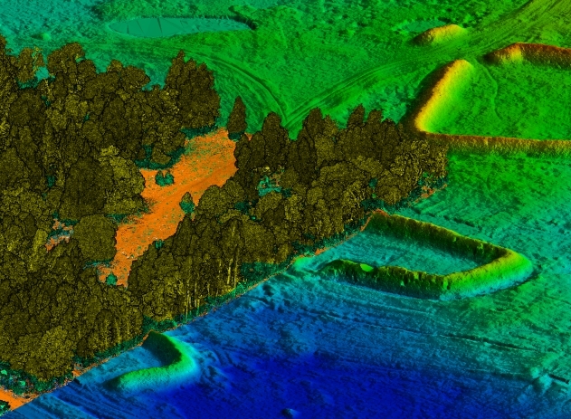
Tiheä kasvillisuus
Luonnonsuojelualueella metsä saa rehottaa rauhassa, joten ihmisen aiemmat puuhat alueella – usean vuosituhannen ajan – uinuvat nykyään varsin rauhassa. Hyvällä luokittelulla kasvillisuus poistetaan maaston topografian päältä.
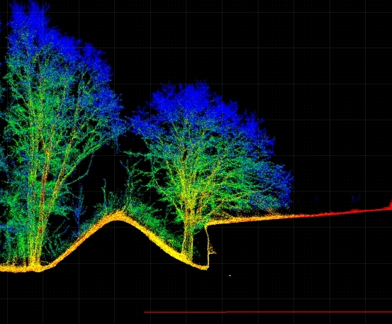
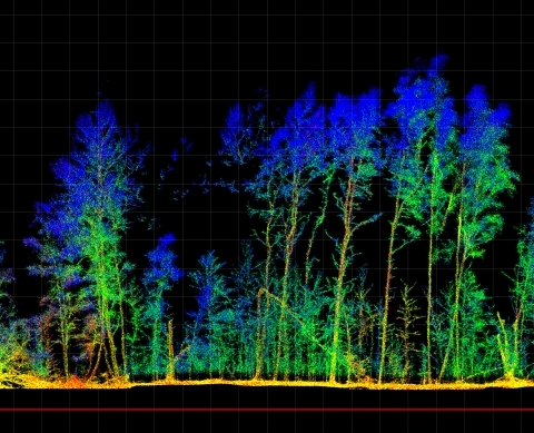
Puiden rungot
VUX-160 laserskanneri mittaa kolme eri profiilia samanaikaisesti ja kaksi niistä vinoon maata kohti. Näin kaikki kohteet saadaan mitattua eri suunnilta, mutta erityisesti pystysuorat kohteet kuten puut, pylväät ja julkisivut kuvautuvat huomattavalla tarkkuudella.
LASER SCANNERS

Why choose RIEGL technology?
Riegl's LiDAR technology doesn't just measure distances, it analyzes the world.
