Land laser scanners
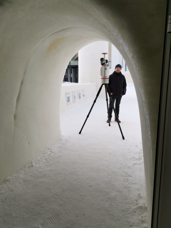
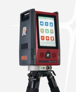
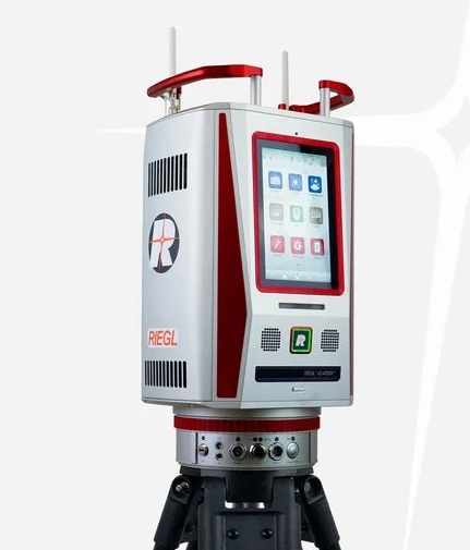
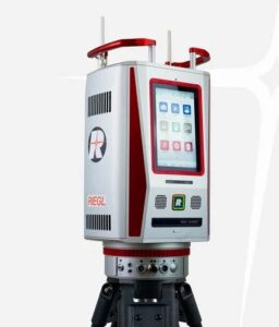
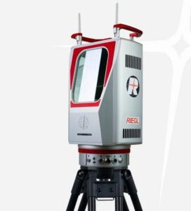
Did you know that RIEGL's ground laser scanners allow for much more than traditional static measurements? The VZi series scanners, like their predecessors, could also be installed as mobile laser scanners, meaning they could scan accurately even from a moving platform. With the latest Riegl VZ-600i and VZ-1200i scanners, you can measure on the move without additional equipment, such as an external GNSS-IMU system, simply by launching the scanner's internal application.
The product images below will take you directly to the manufacturer's website, product presentation page and download the latest technical data for the scanning systems. Feel free to contact us if you would like more information!
Liikkuvaa mittausta maalaserskannerilla?
Kyllä vaan, Rieglin maalaserskannerit ovat olleet liikkuvan mittauksen mahdollistavia jo alusta, 1998 julkaistusta ensimmäisestä kappaleesta alkaen. Vuoteen 2024 asti siihen tarvittiin aina ulkoinen GNSS/IMU lisävarustus hyvänlaatuisen pistepilven tuottamiseksi. Nyt VZ-400i, VZ-600i, VZ-1200i ja VZ-2000i toimivat kaikki myös itsenäisinä liikkuvina eli kinemaattisina laserskannereina ilman sen kummempia lisävarusteita. Kinemaattinen mittausohjelma käynnistetään skannerin sisäisen sovelluksen kautta ja sitten eikun menoksi.
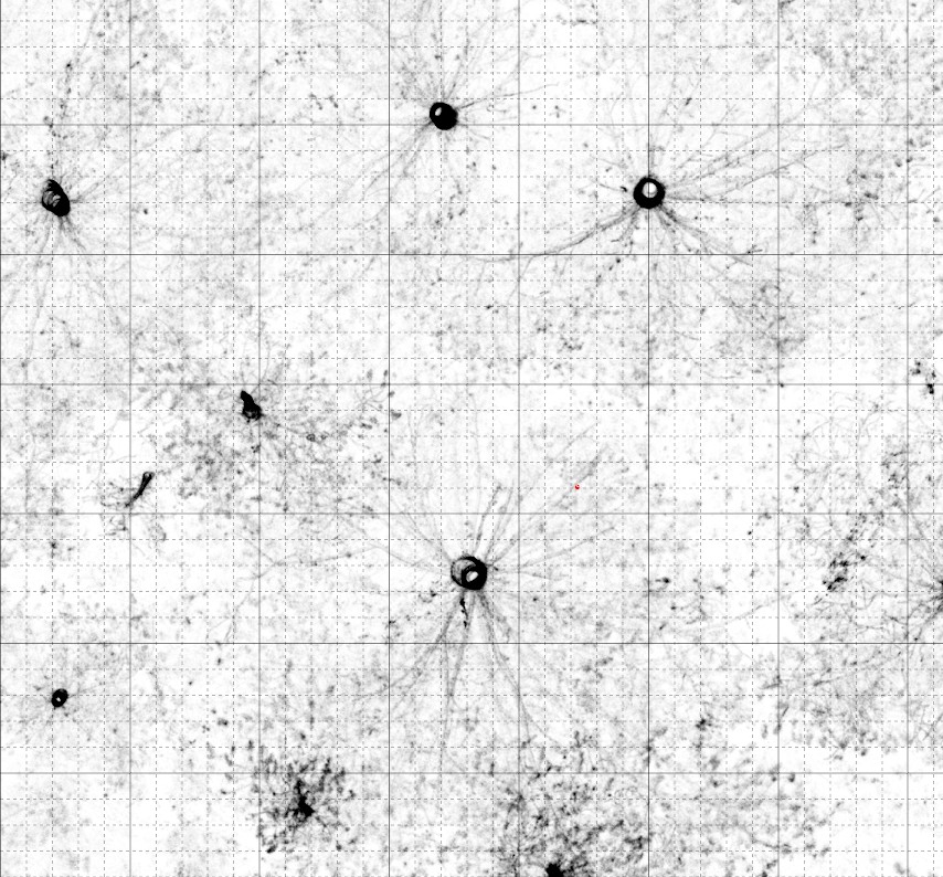
Tyypillisesti kinemaattinen mittaus perustuu suoraan georeferointiin (GNSS+IMU) tai SLAM-mittaukseen. RIEGL on siirtynyt puhtaasta sensoripohjaisesta paikannuksesta aineistolähtöiseen ja kohteeseen perustuvaan orientointiin. Siinä liikerataa korjataan SLAMin menetelmillä mutta samalls myös integroidaan pistepilvestä saatu geometrinen tieto suoraan osaksi radanmäärityksen estimointialgoritmeja (kuten Kalman-suodatusta) yhdessä IMU- ja GNSS-datan kanssa. Koska RIEGLin laserratkaisu on niin hyvä, niin geometrinen tuki liikeradan parantamiseen on myös erinomainen. Menetelmän avulla myös minimoidaan liitos – ja kontrollipisteiden käytön tarve – niitä ei tarvita. Jos RTK-korjaustarkkuus riittää mittauksillesi, niin georeferointi on siis suoraan valmis. Tarvittaessa voit kalibroida aineiston paikalliseen korkoon, jos GNSS-korjausratkaisun tarkkuus ei ole riittävä. Tyypillisesti tätä mittausratkaisu kuljetetaan mönkijällä, pyörällä, ihmisalustalla tai muusta hitaasti liikkuvasta ajoneuvosta aina 20 km/h nopeuksiin asti. Rieglin muuta mobiililaserskannusratkaisut otetaan käyttöön, jos tarvetta on liikkua nopeammin aina moottoritienopeuksiin asti tai radoilla vielä nopeammin.
Tyypillisesti kinemaattinen mittaus perustuu suoraan georeferointiin (GNSS+IMU) tai SLAM-mittaukseen. RIEGL on siirtynyt puhtaasta sensoripohjaisesta paikannuksesta aineistolähtöiseen ja kohteeseen perustuvaan orientointiin. Siinä liikerataa korjataan SLAMin menetelmillä mutta samalls myös integroidaan pistepilvestä saatu geometrinen tieto suoraan osaksi radanmäärityksen estimointialgoritmeja (kuten Kalman-suodatusta) yhdessä IMU- ja GNSS-datan kanssa. Koska RIEGLin laserratkaisu on niin hyvä, niin geometrinen tuki liikeradan parantamiseen on myös erinomainen. Menetelmän avulla myös minimoidaan liitos – ja kontrollipisteiden käytön tarve – niitä ei tarvita. Jos RTK-korjaustarkkuus riittää mittauksillesi, niin georeferointi on siis suoraan valmis. Tarvittaessa voit kalibroida aineiston paikalliseen korkoon, jos GNSS-korjausratkaisun tarkkuus ei ole riittävä. Tyypillisesti tätä mittausratkaisu kuljetetaan mönkijällä, pyörällä, ihmisalustalla tai muusta hitaasti liikkuvasta ajoneuvosta aina 20 km/h nopeuksiin asti. Rieglin muuta mobiililaserskannusratkaisut otetaan käyttöön, jos tarvetta on liikkua nopeammin aina moottoritienopeuksiin asti tai radoilla vielä nopeammin.
Why choose RIEGL technology?
Riegl's LiDAR technology doesn't just measure distances, it analyzes the world.
