Confidence in managing critical infrastructure
The energy industry and those responsible for security of supply are constantly facing challenges related to aging infrastructure, weather conditions and stricter safety regulations. Laser scanning (LiDAR) offers energy companies and grid operators an efficient way to monitor and maintain their assets – from power lines and transformers to the complex structures of nuclear power plants and renewable energy facilities.
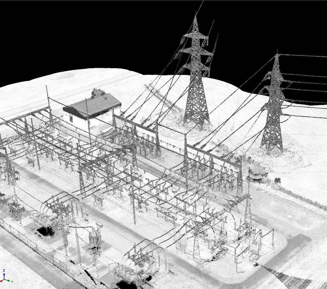
In the energy sector, laser scanning is an investment in operational reliability. It provides a clear view of the network status, optimizes maintenance costs, and ensures that critical infrastructure remains operational under all conditions.
What is laser scanning used for in the energy sector?
Laser scanning is an invaluable tool for inspecting large networks and point-like objects:
- Monitoring of electrical networks: Analyzing power line sags, checking pole straightness, and creating digital twins of the network.
- Vegetation Management: Analyzing critical distances between trees and power lines to prevent power outages and forest fires.
- Documentation of power plants: Accurate modeling of complex process industry pipelines, boilers and turbine halls for modification work.
- Renewable energy: Inspection of wind turbine blades, layout planning of solar panel fields and monitoring of hydropower plant structures.
How does laser scanning help energy professionals?
Technology transforms risk management from passive reaction to active and proactive action:
1. Effective vegetation control LiDAR is a superior method for identifying vegetation that threatens power lines. Automated point cloud analysis instantly reveals locations where branches are growing too close to the lines or where individual trees are at risk of falling onto the line, allowing you to target clearing resources to the right locations.
2. Measurements without interruptions Aerial laser scanning (manned or drone) allows you to inspect high-voltage networks from a safe distance without having to turn off the power. This saves considerable amounts of money and improves delivery reliability. With a ground laser scanner, you can see details that are hidden when measuring from above.
3. Accurate situational awareness in exceptional situations After storms or other natural disasters, laser scanning offers a quick way to map damage over large areas. Digital data helps prioritize repair efforts and estimate the materials needed before teams are sent into the field.
4. Optimized resource utilization and planning With an accurate 3D model of the existing infrastructure, adding new components or increasing capacity can be planned with millimeter accuracy from the office, minimizing surprises during installation and reducing maintenance downtime.
5. Safety and compliance In critical sites, such as nuclear power plants or large dams, laser scanning enables highly accurate monitoring of structural deformations. This helps meet strict regulatory requirements and ensure the safe operation of the facilities.